


Aerial Monitoring of Ocean Vessels
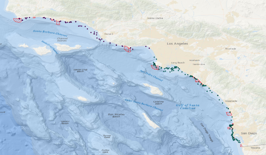
Since 2008, The Bay Foundation (TBF) and its partner LightHawk have been conducting coastal aerial surveys of boating activities in state waters off the mainland coast of Southern California. Monitoring is focused on the Southern California Bight, divided into two transects—the north transect, which stretches from Los Angeles International Airport (LAX) to Point Conception, and the south transect, from LAX to the U.S.-Mexico border.
This aerial monitoring project was originally initiated to generate and provide a spatially explicit, objective, fishery-independent data set showing the extent of boating activities for the Marine Protected Area (MPA) planning process off the coast of Southern California.
Today, the data are used to evaluate and monitor MPA compliance, as well as water quality improvement projects, kelp forest restoration, ecosystem-based management, and other management actions that may affect boating activities.
Project Highlights


Progress to Date
Since launching in 2008, the Aerial Monitoring Project has successfully included:
- 41 flights and 5,304 boats logged pre-MPA implementation (2008- 2011)
- 82 flights and 15,399 boats logged post-MPA implementation (2012- 2019)
- 1 peer-reviewed scientific publication on survey findings (Zellmer et al. 2018)
Development of the South Coast Marine Life Protection Act
TBF conducted aerial monitoring surveys that were able to provide stakeholders and decision makers with information on the type and extent of boating activities to help determine the locations for a network of Marine Protected Areas (MPAs), which contributed to the implementation of the South Coast Marine Life Protection Act initiative in 2012.

The Aerial Monitoring Survey Team and Process
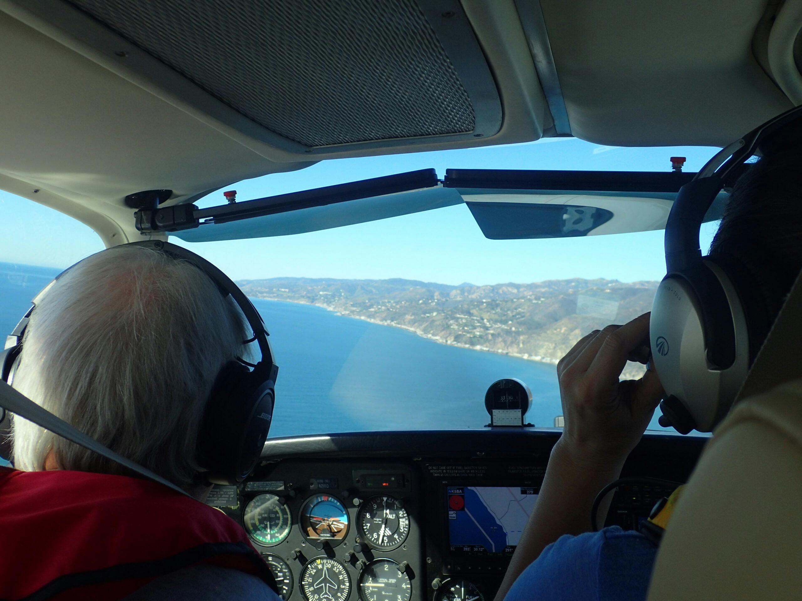
In addition to the small aircraft pilots from LightHawk who generously donate their time and planes to the project, TBF survey teams consist of a spotter and a GPS technician. The aircraft are capable of high maneuverability and low speeds, and can fly directly over a vessel in the ocean to accurately mark its location. The spotter uses binoculars to view an ocean vessel and directs the pilot to its location. The GPS technician collects a GPS waypoint once the plane is directly overhead and records the vessel type and activity identified by the spotter.
Continued Aerial Survey Monitoring
Since the implementation of the South Coast MPA network in 2012, data from the aerial surveys has provided in-depth descriptions and analyses of both trends in fishing activities, as well as compliance with the new regulations, assisting with the adaptive management and enforcement of the network.

Progress to Date
Since launching in 2008, the Aerial Monitoring Project has successfully included:
- 41 flights and 5,304 boats logged pre-MPA implementation (2008- 2011)
- 82 flights and 15,399 boats logged post-MPA implementation (2012- 2019)
- 1 peer-reviewed scientific publication on survey findings (Zellmer et al. 2018)
Development of the South Coast Marine Life Protection Act
TBF conducted aerial monitoring surveys that were able to provide stakeholders and decision makers with information on the type and extent of boating activities to help determine the locations for a network of Marine Protected Areas (MPAs), which contributed to the implementation of the South Coast Marine Life Protection Act initiative in 2012.
